
Fly over the Ring of Fire eclipse of October 14, 2023!
Watch the Moon's shadow race from Oregon to Texas on October 14, 2023! This flyover video animation chases the 'Ring of Fire' eclipse from 125 miles high at speeds from 7,000 mph to 1,700 mph. Anyone with eclipse glasses inside the dark oval will see the blazing sight of the Sun appearing as a slender brilliant ring.
If you could design an eclipse path that maximizes the number of national parks in its path, this is it! See the eclipse fly over Crater Lake National Park, Great Basin National Park, and others in the Four Corners region. The archeo-astronomical site at Chaco Canyon is ideally situated for a dramatic eclipse. In Texas, the path of this eclipse intersects the path of the April 8, 2024 total solar eclipse in the San Antonio region.
The video was created by Michael Zeiler, of GreatAmericanEclipse.com. The 3000 frames were composed in ArcGIS Pro and Adobe Illustrator with additional specialized Python and Javascript code. Eclipse predictions by Fred Espenak, and eclipse computations by Xavier Jubier.
The dark oval represents where the thin ring of the Sun, the 'Ring of Fire', will be seen at that moment. The time of eclipse is given in the local time zone. The duration is the maximum at the center of the Moon's shadow. Places near the centerline receive the longest duration.
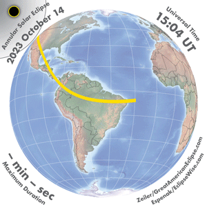
Annular solar eclipse of October 14, 2023
Eleven years after an annular solar eclipse crossed the western United States on May 20, 2012, another annular eclipse will race across the USA from Oregon to Texas on Saturday, October 14, 2023. The path of the annular eclipse next visits Central America and South America, and ends shortly after at sunset in the Atlantic Ocean. In the USA, the annular solar eclipse begins in Oregon at 9:13 a.m. PDT and ends in Texas at 12:03 p.m. CDT.
These are some key cities and national parks inside the path of annular eclipse.


The Moon’s Shadow
This animated GIF shows the annular eclipse path arcing across the Pacific, crossing the United States from Oregon to Texas, then sweeping over Central America and South America.
The inner black circle, the antumbra, is where the Moon appears completely within the Sun’s disk. The outer shadow circle, the penumbra, shows the partial eclipse. The partial eclipse will be slight near the outer circle and deep near the path of annularity. In a deep partial eclipse, the sky will cool and sunlight will take on an eerie quality.
Viewing the annular solar eclipse

From begin to end, the eclipse will last about two and a half hours in total
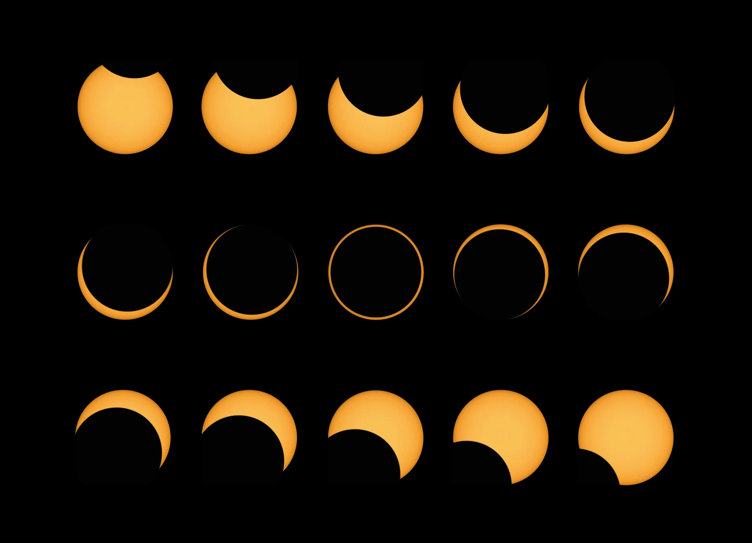
During an annular solar eclipse, the apparent size of the Moon’s disk is slightly smaller than the apparent size of the Sun’s disk. Therefore, only the outer edge of the Sun remains visible and the Sun appears as a brilliant ring if you are inside the path of annular solar eclipse. This is an otherworldly sight often called a “ring of fire”. Here are instructions for the safely viewing solar eclipses by the American Astronomical Society and several professional organizations.
This eclipse will be a warm-up act for the spectacle of the total solar eclipse crossing the United States just 177 days later on April 8, 2024. While not as dramatic as a total solar eclipse, an annular solar eclipse promises a spectacular vision featuring the striking sight of the Sun as a ring. We recommend solar binoculars for viewing the dynamic Baily’s Beads, sparkling points of brilliant sunlight as the Moon’s limb rolls over the Sun’s edge.
Click on any eclipse map on this page for the highest-resolution display.
The path of annularity across the United States. This map available in two sizes at https://www.greatamericaneclipse.com/eclipse-maps-and-globe/2023map
Annular Solar Eclipse over the United States
Learn more about the annular solar eclipse in each of the states inside the path of totality by clicking the links below.


Eclipse times and durations inside the path of annular solar eclipse
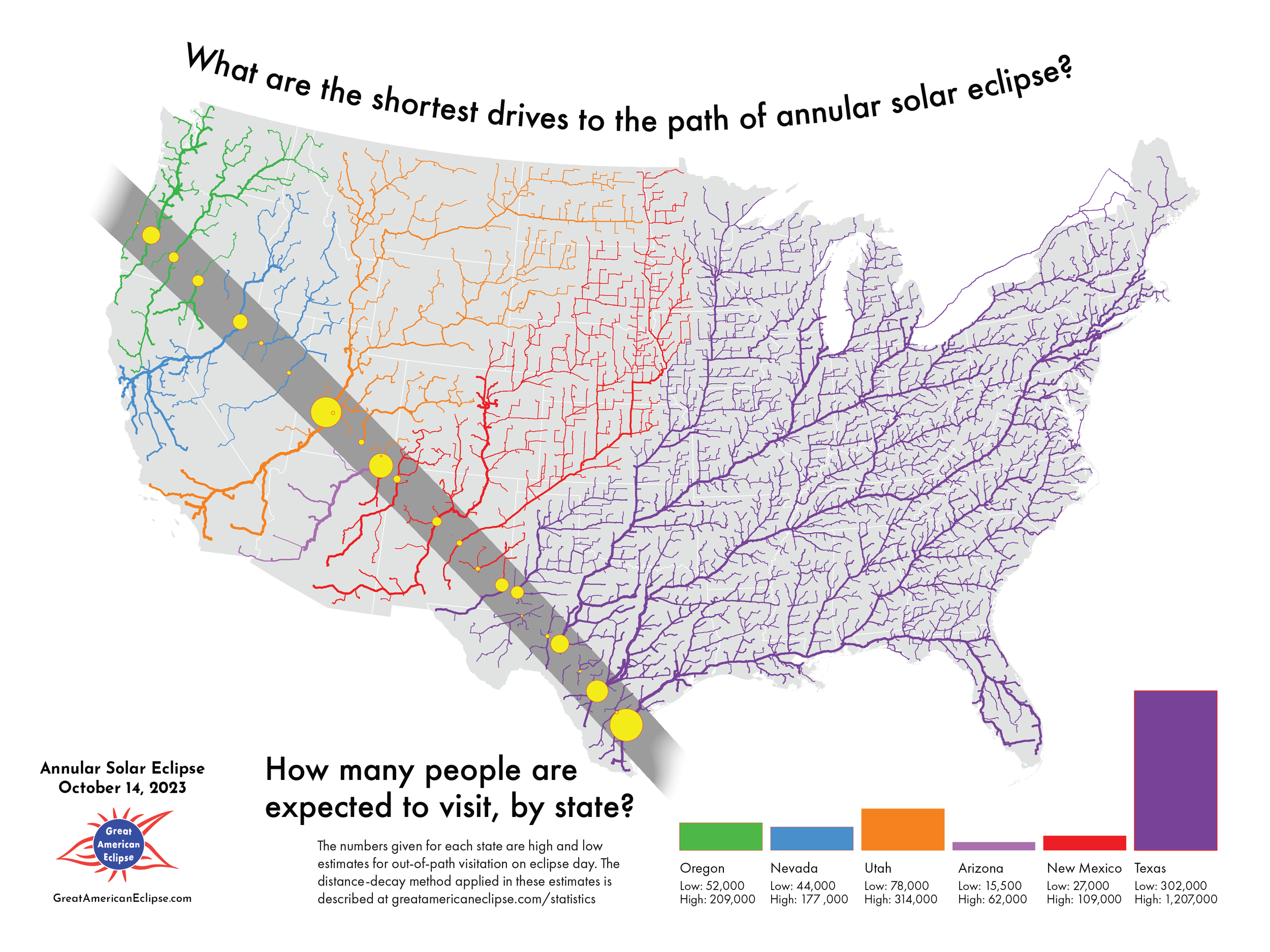
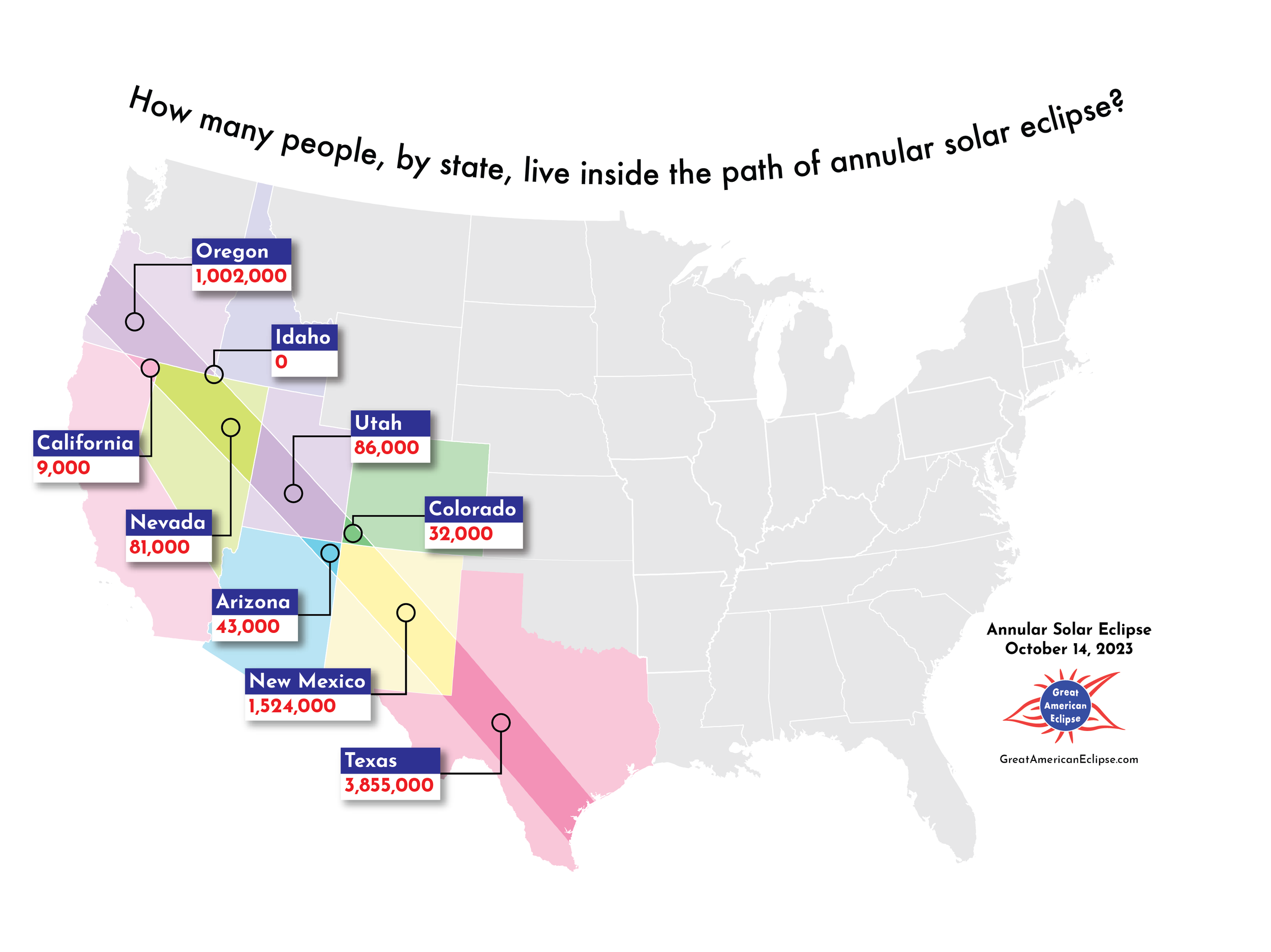
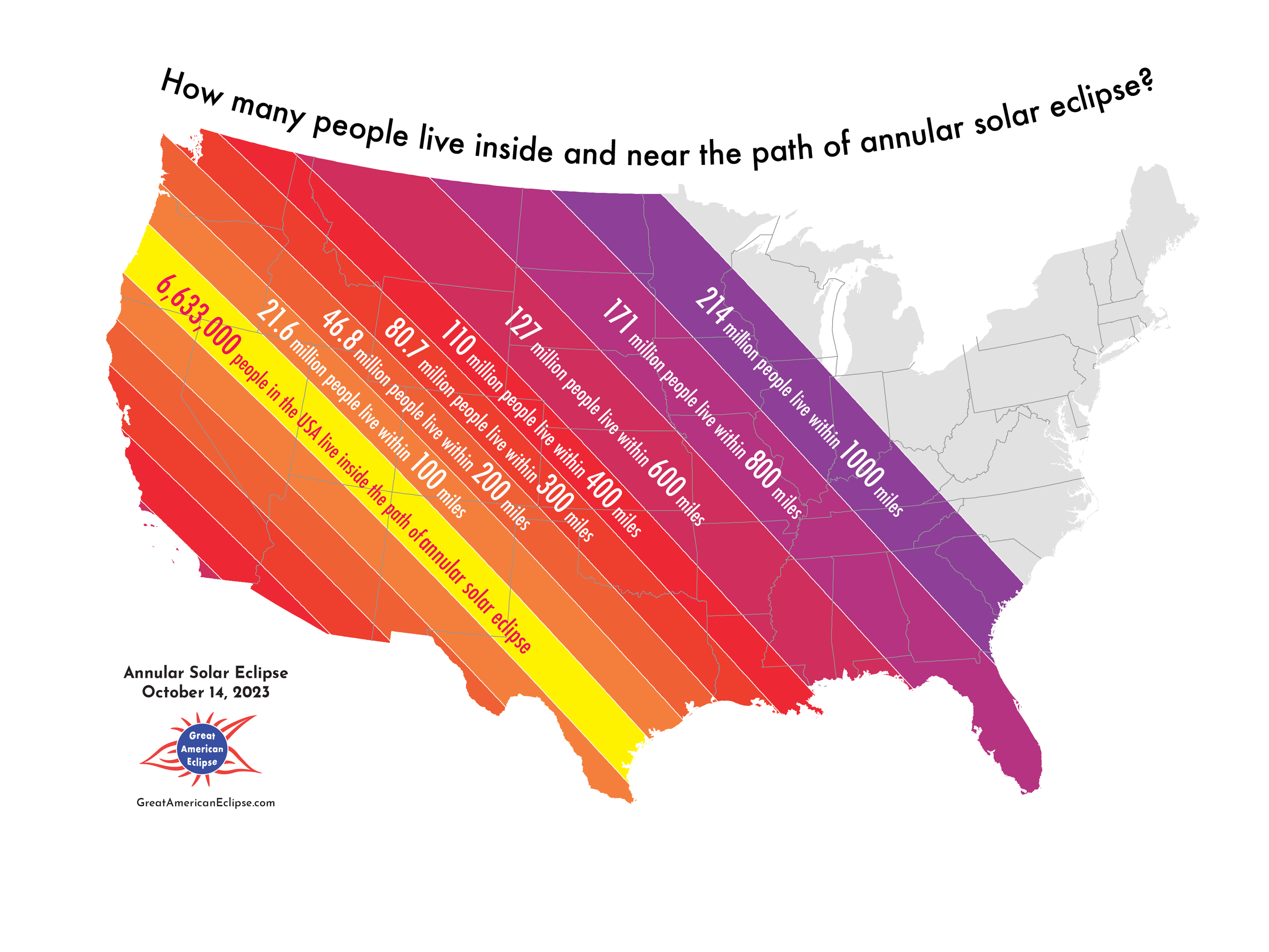
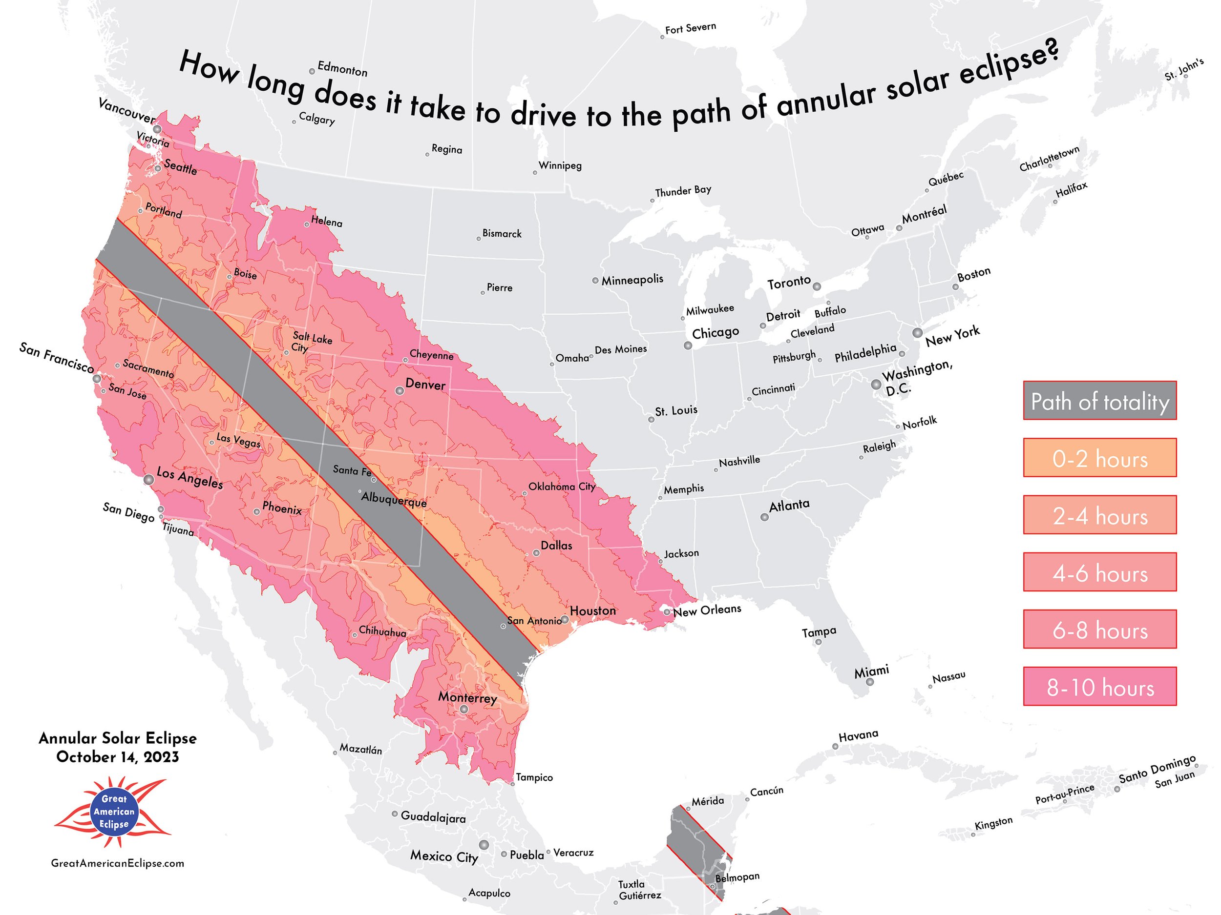
Eclipse impact
The maps in this gallery start with a summary of the population inside and near the path of annularity, and then make an estimate of how many people might come to visit. These maps are computed using ArcGIS software by Esri on 2020 US Bureau of the Census population tabulations and the road network.
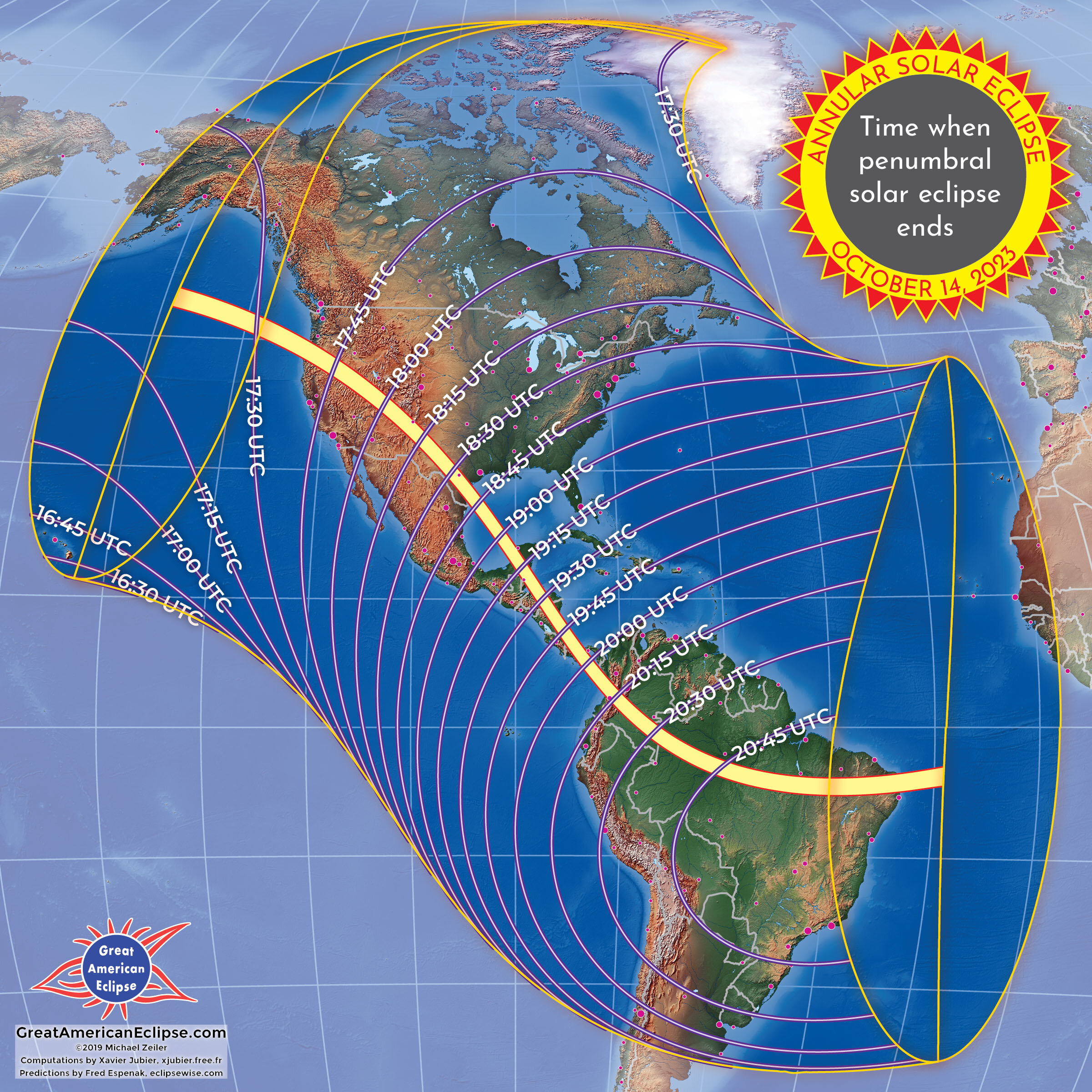
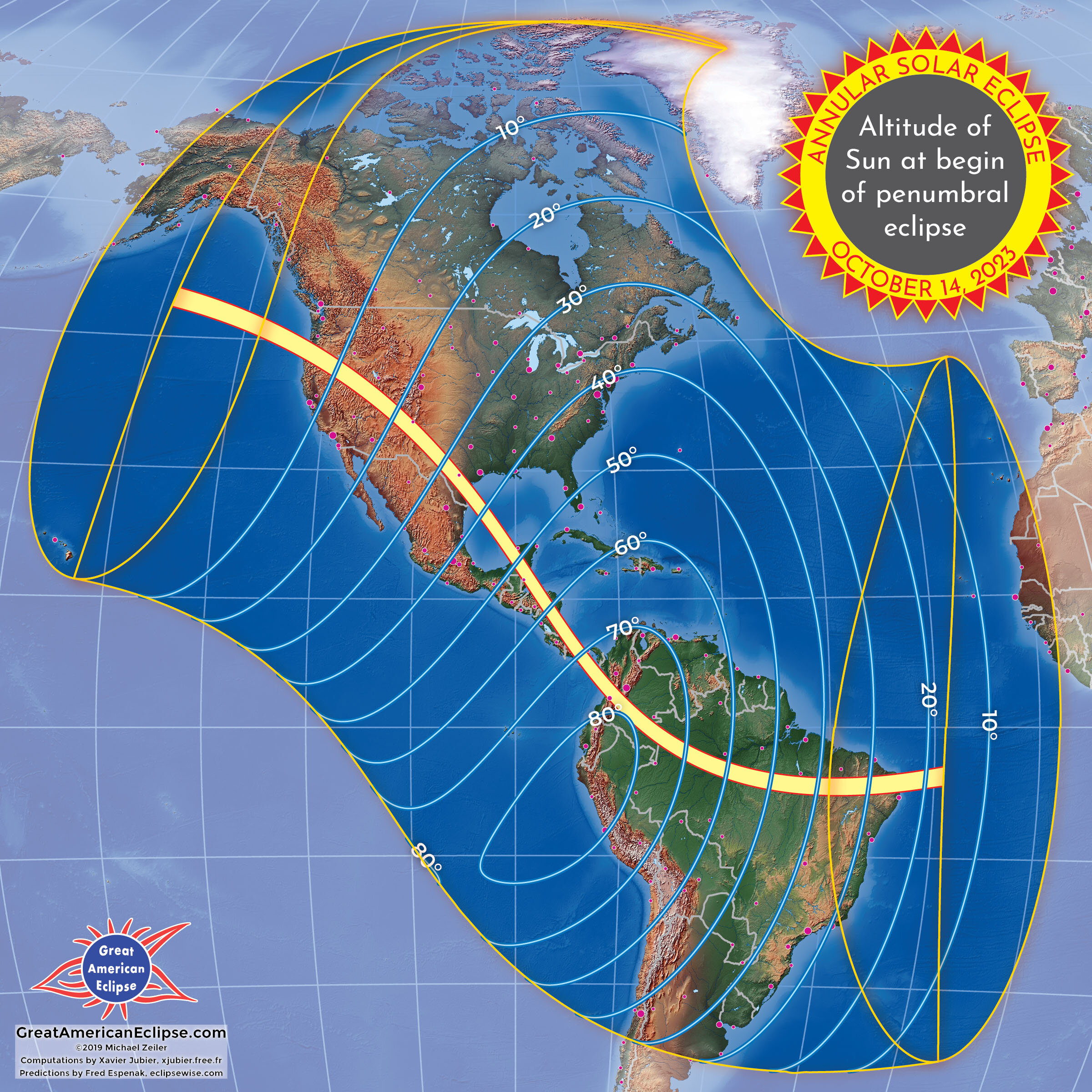
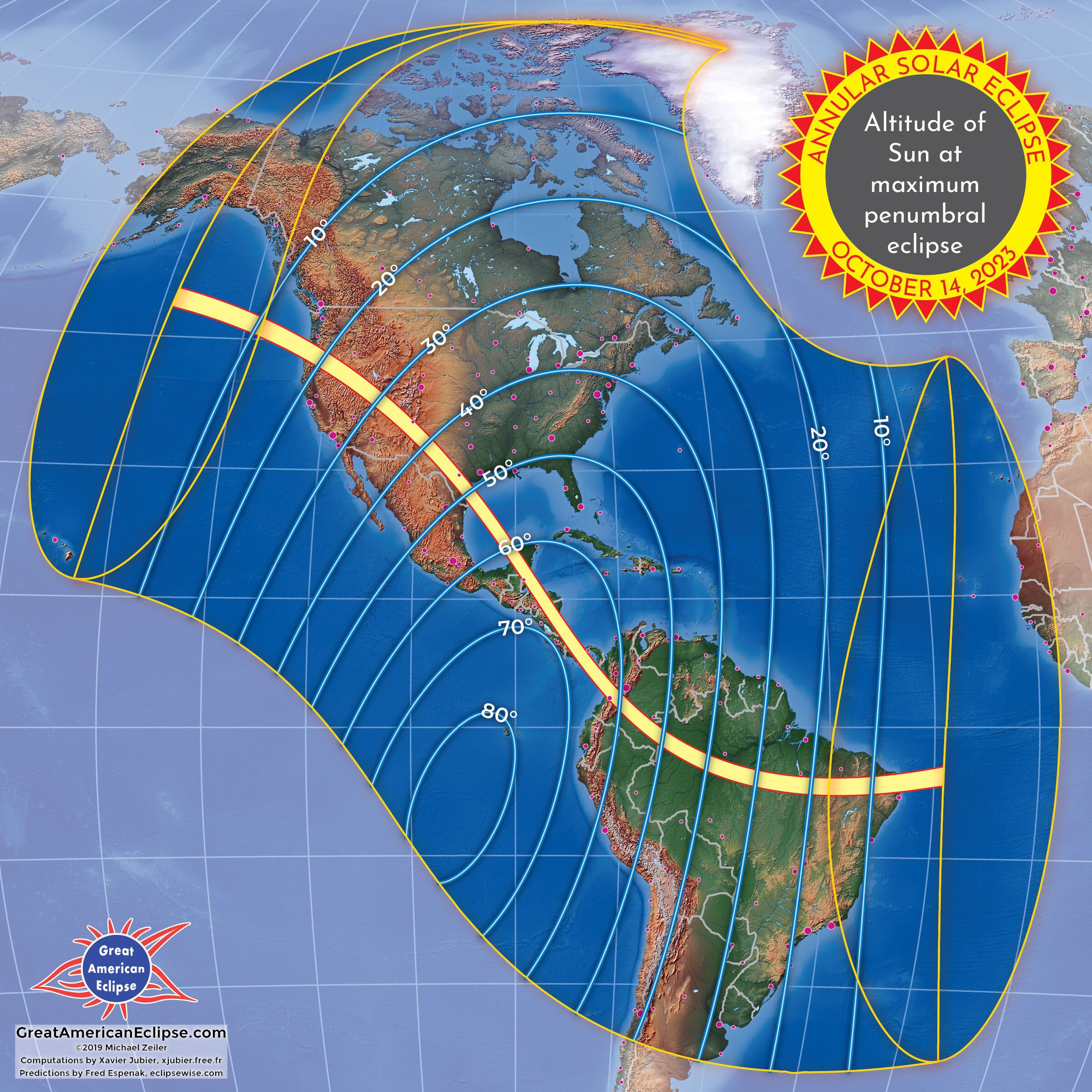
Eclipse circumstances
These maps provide an overview of the key circumstances of the eclipse. Click on the navigation arrows or thumbnails on bottom to scroll through the maps.
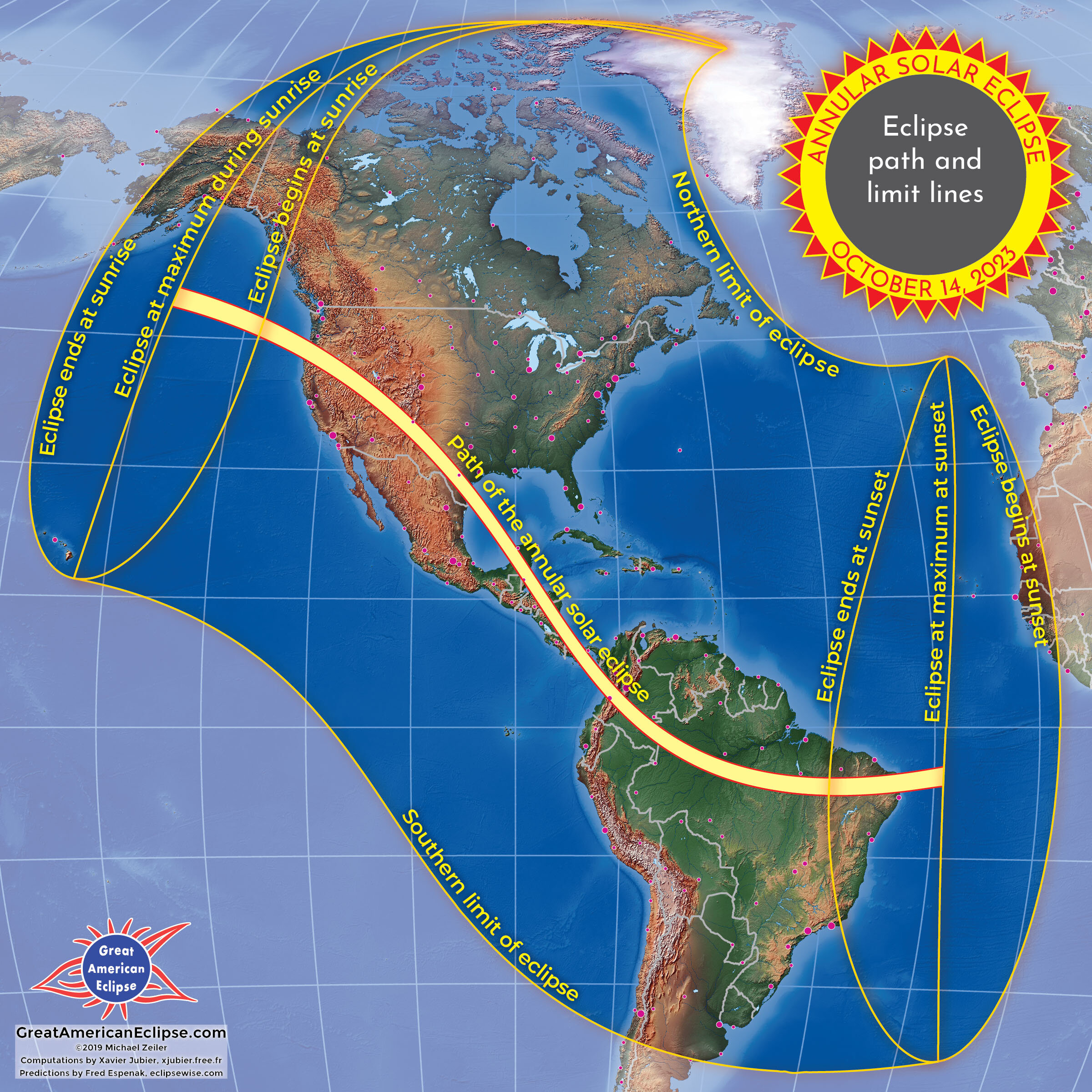
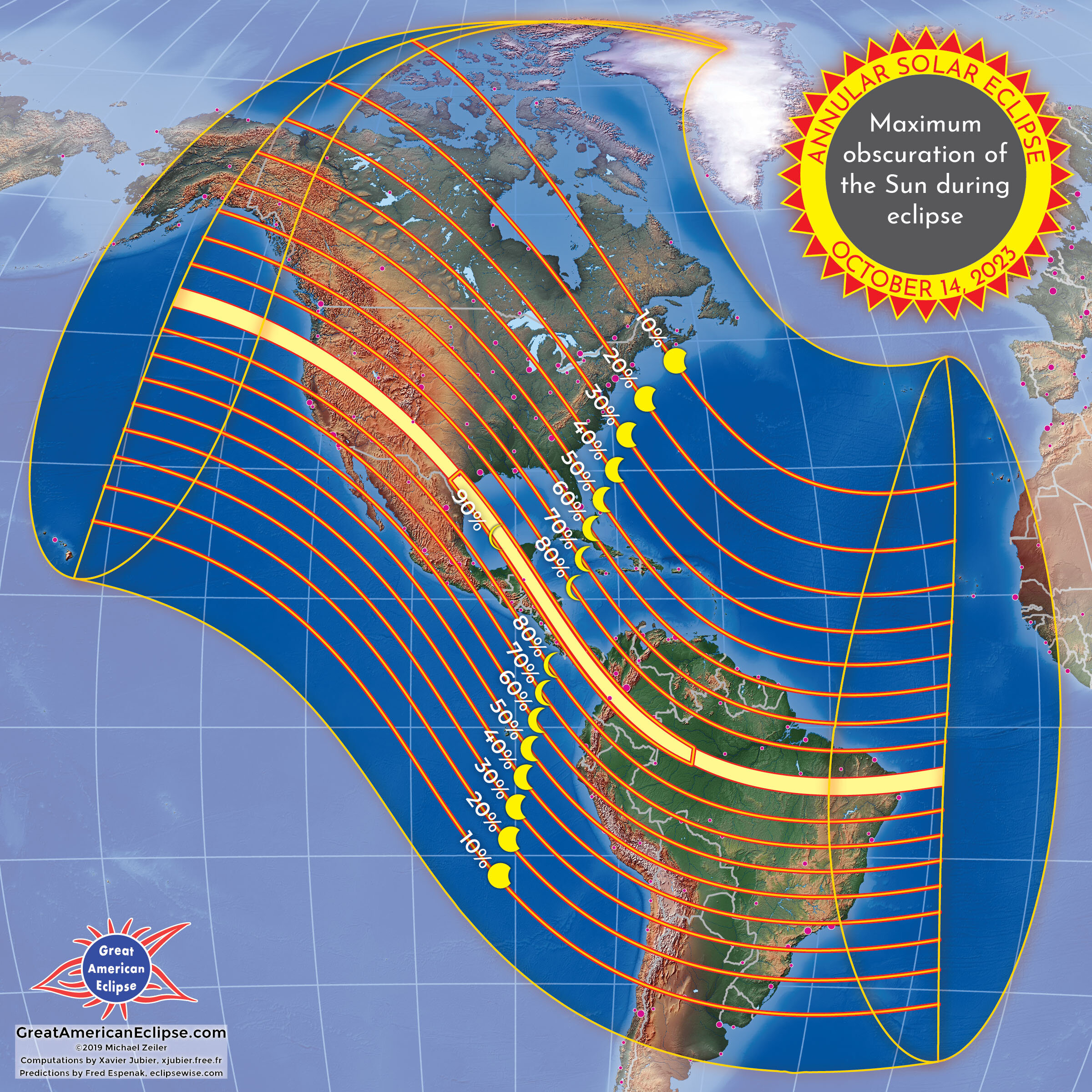
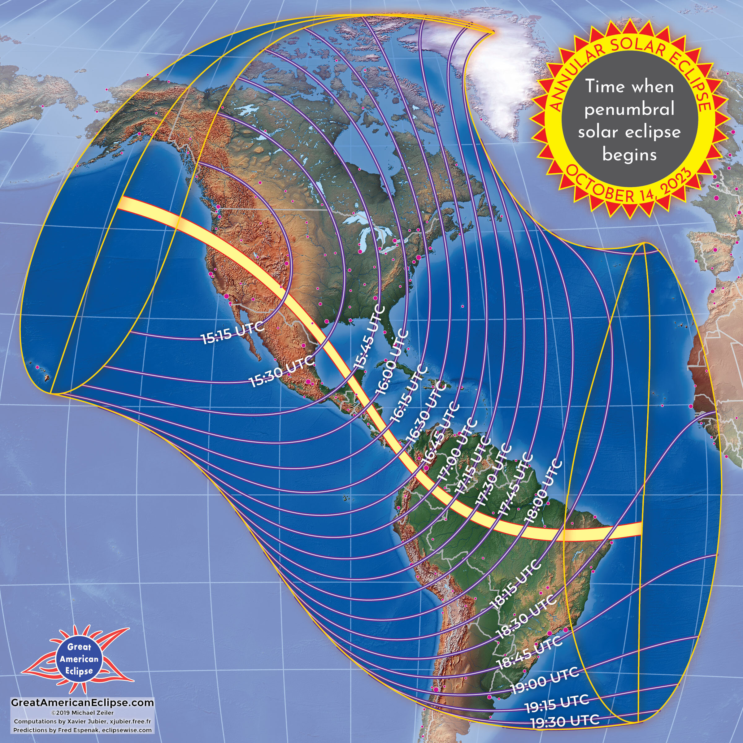
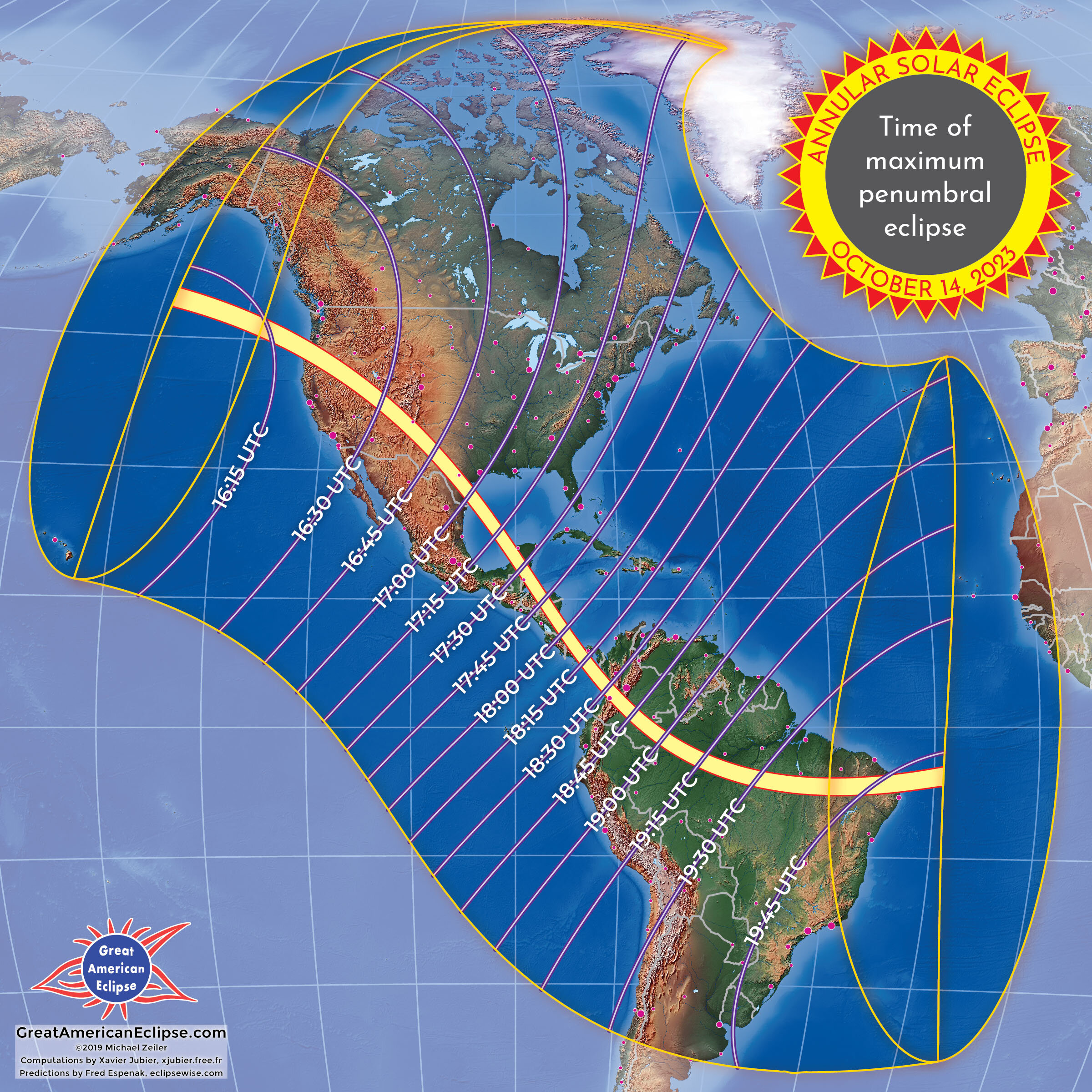

The annular solar eclipse across North America, Central America, and South America
These three maps below provide an overview of the eclipse across the Americas. The region where the Moon will slide within the disk of the Sun is the orange band labeled the path of annular solar eclipse. Outside the path shows the maximum degree of obscuration, simulated at maximum eclipse by the partial eclipse figures. All of North America, except for northwest Alaska, will experience at least a partial solar eclipse. Most of South America, except for southern Chile and Argentina, will also experience at least a partial solar eclipse.
Click on the left and right arrows to navigate through three maps spanning the Americas.
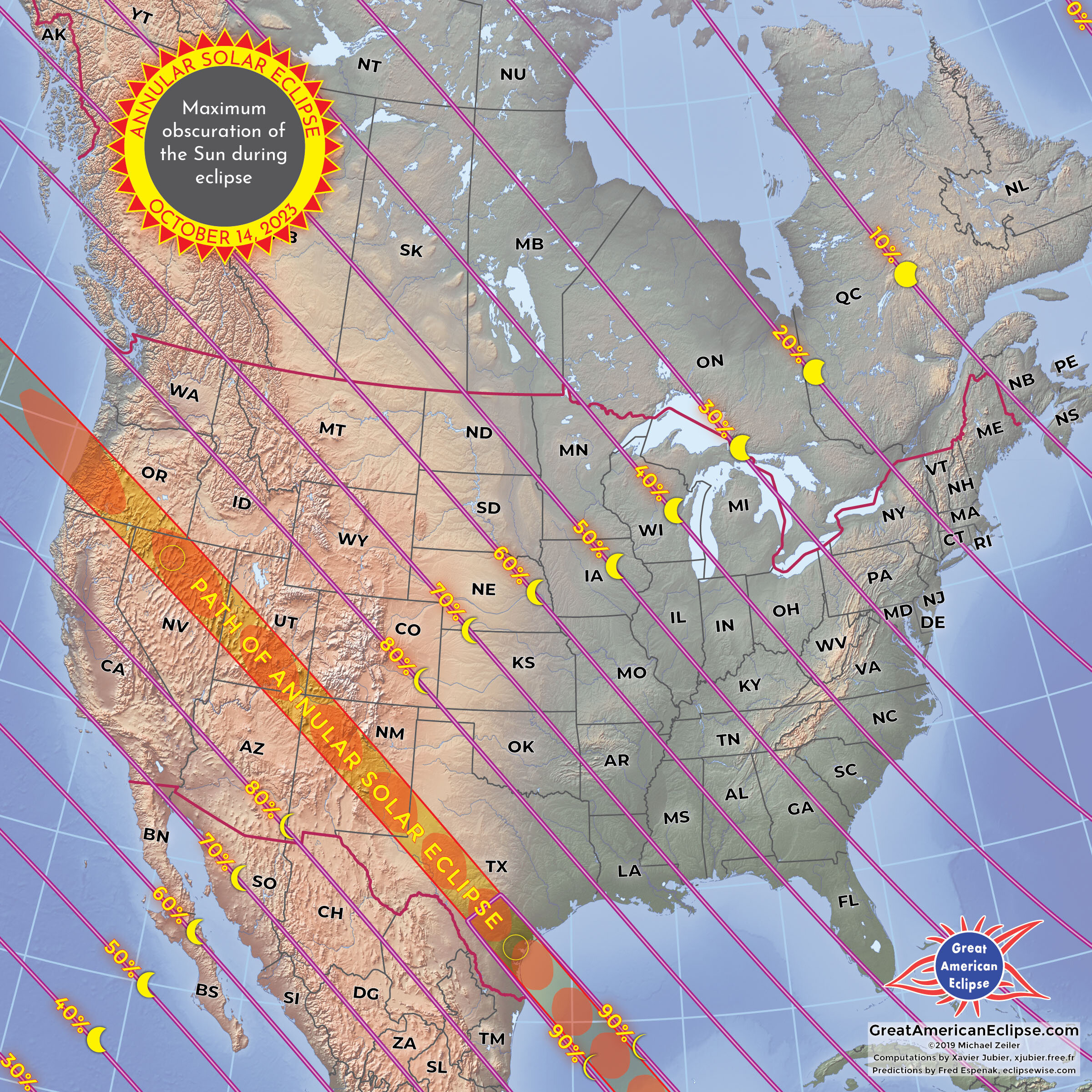
The path of annular solar eclipse over Oregon, California, and Nevada
The annular solar eclipse first touches the United States at 9:13 a.m. PDT at Reedsport, Oregon. The shadow of the Moon at this point is screaming at 7,534 miles per hour. The maximum duration of annularity at the Oregon coast is 4 minutes, 29 seconds and the eclipse will be 13 degrees high in the sky.
The path of annular solar eclipse over Utah, Arizona, Colorado, and New Mexico
The eclipse passes over the Four Corners region and many national parks and national monuments will be prime viewing locations. The weather prospects are good in this area and an eclipse trip can be combined with a vacation to some of the many scenic parks in the American Southwest. Several distinctive viewing locations are through an arch at National Bridges National Monument, from the crimson hoodoos at Bryce Canyon National Park, framed by the pre-Columbian structures at Chaco Canyon, and in scenes from the ranch country around Roswell, New Mexico.
The path of annular solar eclipse over Texas
The annular eclipse will cross Texas and visit the metropolitan areas of Midland and Odessa, San Antonio, and Corpus Christi. The shadow of the Moon leaves the United States at Padre Island at 12:03 p.m. CDT. At this point, the Moon’s shadow is moving at 1,722 miles per hour and the eclipse will be 51 degrees high in the sky. The maximum duration of annular solar eclipse in Texas is 4 minutes and 53 seconds.
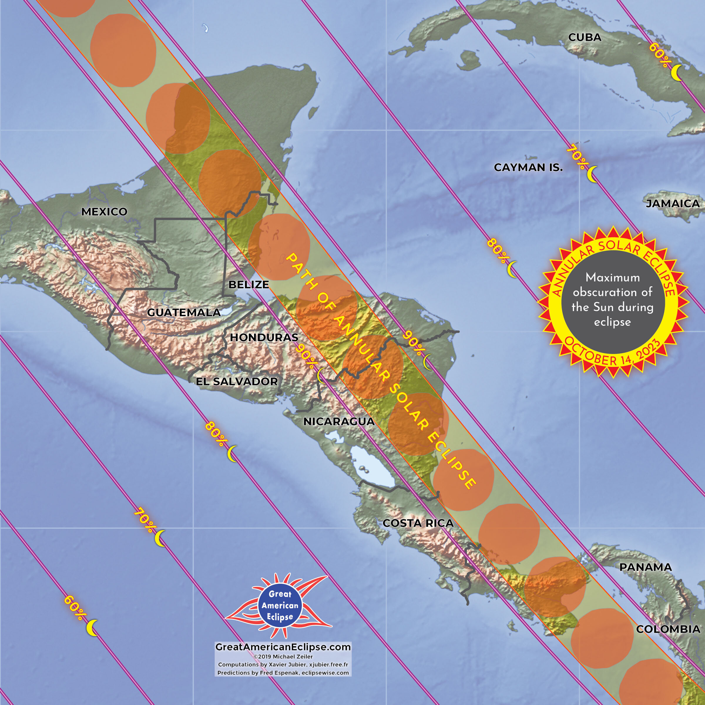
The path of annular solar eclipse over the Yucatan Peninsula
After crossing the Caribbean Sea, the annular solar eclipse will make landfall on the Yucatan Peninsula. Annularity touches three countries here; Mexico, Guatemala, and Belize. Belize City is well located for a duration of eclipse longer than 5 minutes.
The path of annular solar eclipse over Honduras and Nicaragua
Next, the annular solar eclipse will sweep over the island of Roatan and the mainland of Honduras. The duration of annular solar eclipse will reach 5 minutes and 5 seconds near the beach resort of Bluefields, Nicaragua on the Atlantic coast. The major cities of Managua and Tegucigalpa will experience 88% and 89% partial solar eclipse.
The path of annular solar eclipse over Panama
A long stretch of the Pan American highway in Panama is inside the path of annular solar eclipse. Unfortunately, the Panama Canal and Panama City lie just north of the path of annularity, but will experience a deep partial solar eclipse.
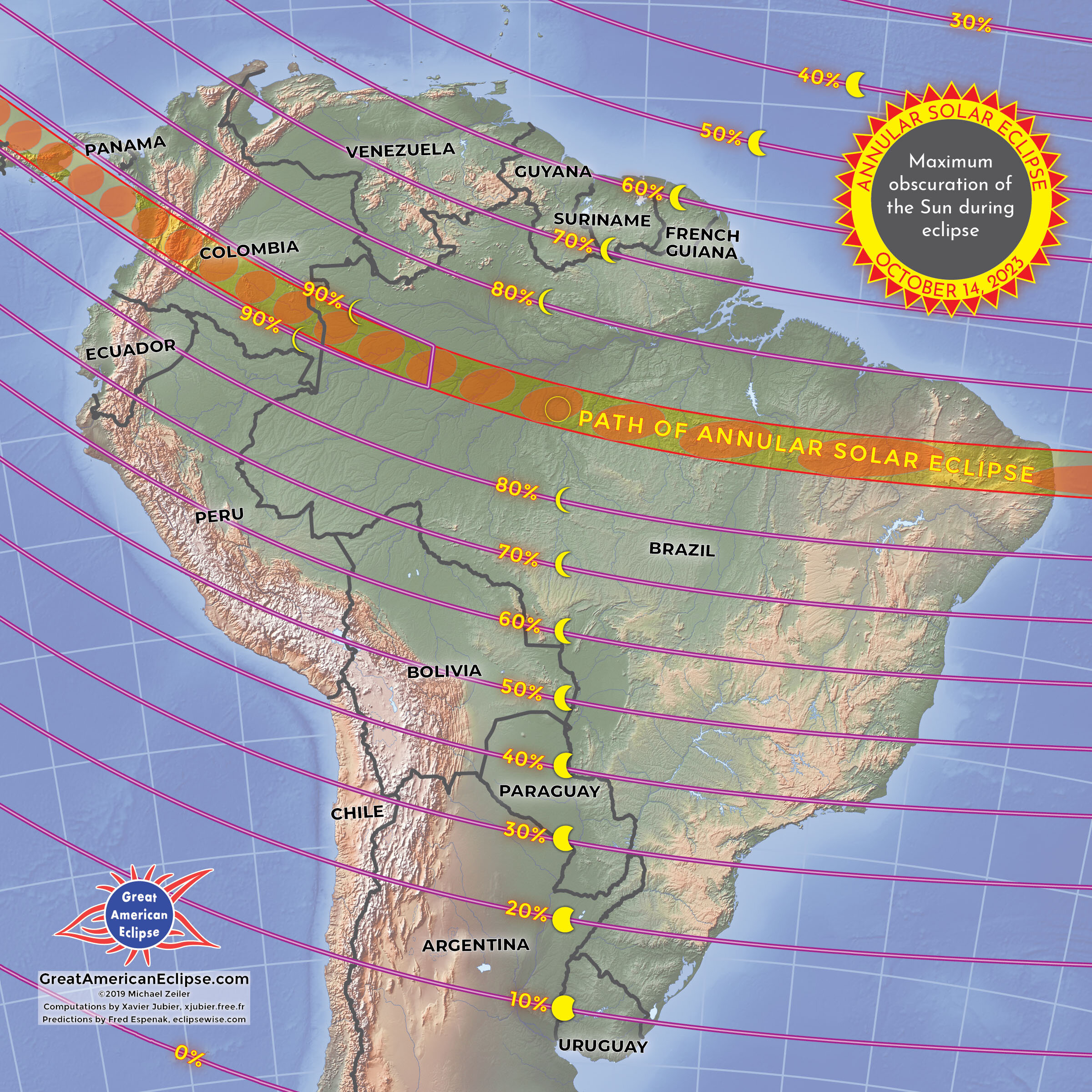
The path of annular solar eclipse over Colombia
The city of Cali in Colombia will witness over 3 minutes of annularity in the early afternoon. Bogota and Medellin will experience a deep 88% partial solar eclipse.
The path of annular solar eclipse over Colombia and northwestern Brazil
The path of annular solar eclipse next will visit the Amazonian rainforest of western Brazil. The city of Manaus on the Amazon River is just north of the path of annular solar eclipse.
The path of annular solar eclipse over eastern Brazil
The annular solar eclipse will then traverse Brazil to Natal on the Atlantic coast. Soon after leaving Brazil just north of Recife, the annular solar eclipse will end at sunset. Given good weather, a ship in this area will see the spectacular sight of the setting annular solar eclipse on the horizon.
Eclipse resources
Several informative and authoritative websites provide additional content on this and other eclipses. They are:
http://xjubier.free.fr/en/site_pages/solar_eclipses/ASE_2023_GoogleMapFull.html is an excellent online eclipse map that you can use to drill down on a viewing location and learn almost every imaginable eclipse data point. This is a resource developed by Xavier Jubier who authored the computation engine used for these eclipse maps, Solar Eclipse Maestro at http://xjubier.free.fr/en/site_pages/solar_eclipses/Solar_Eclipse_Maestro_Photography_Software.html
The foundational calculations for predicting the circumstances of this eclipse are by Fred Espenak, retired NASA Astrophysicist. He provides more information at http://www.eclipsewise.com/solar/SEprime/2001-2100/SE2023Oct14Aprime.html and his eclipse photography and tips are at http://mreclipse.com/ Many of his books are sold on his website and our website.
The authoritative site for eclipse climatology is http://eclipsophile.com/ by Jay Anderson and Jennifer West. Eclipsophile is an essential resource for planning any eclipse travel explaining regional weather patterns and identifying sites with improved weather odds.
The American Astronomical Society runs the comprehensive https://eclipse.aas.org/ website. This website is packed with scientific background, basics of eclipses, advice for observing, and how to safely view solar eclipses.